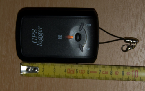
We recently bought a “GPS logger”, with the next vacation in mind. A GPS logger is a small device, that you turn on at the beginning of a trip, you put it in your pocket, and just forget about it, until you get back home … The device itself continously logs your coördinates, where-ever you are on this planet, and store these coördinates with a 5 second interval into it’s internal memory. (You can record up to 150.000 points into internal memory, which equals more then 200 hours) After a trip, you simply download the logfile to your PC via USB, to store it somewhere save, along with your pictures, and clear the memory of the logger. With a little software-tool, you can compare the timestamps of your pictures, with timestamps and coördinates in your logfile, and geo-tag your pictures with the GPS coördinates where they are taken. (Info is stored into the EXIF header of your picture, so it is in the picture-file, but not visible into the image itself. Afterwards you can see pinpoints at google-earth, to indicate the exact location of your pictures. You can even “replay” the logfile, mapped on google earth, (at a self-defined speed), to review your steps 😉
